

Competition name: Competition for grant funding of young scientists under the "Zhas Galym" project for 2025-2027
Project Manager: Yertay T. Yeskaliyev
Identifiers:
- Scopus Author ID 57245212400 (https://kz.h-index.com/en/author/57245212400),
- ORCID 0000-0003-0899-601X (https://orcid.org/0000-0003-0899-601X).
Project Research Team
| № | Full name | Project position | Identifiers (Scopus Author ID, Researcher ID, ORCID, if any) and links to related profiles |
|---|---|---|---|
| 1. |
Yertay T. Yeskaliyev |
Principal Investigator (PI) |
Scopus Author ID: 57245212400, |
|
2. |
Marzhan Ye. Rakhymberdina |
Scientific consultant |
Scopus Author ID: 57189062804, |
Project abstract
Remote sensing (RS) has become a key player for all areas of geosciences, including geology. Unfortunately, in the context of geology and mineral deposit exploration in Kazakhstan, classical methods of field work and laboratory analysis are most widely used.
In many developed and developing countries, RS is the primary and decisive analysis in geology for two reasons - time and money. Despite the high cost of the technology itself, the data obtained from satellites is either of little or no value. Today, RS is enhanced by other methods: geographic information systems (GIS) and deep learning methods of artificial intelligence (AI). This integration has already proven itself to be a successful for predicting mineral deposits worldwide, including gold-bearing ones, which is the goal of this research.
This project plans to integrate archival data from deposits, RS, GIS and AI. This interdisciplinary combination covers a wide range of sciences, thus influencing blends severaд fields into one projecе.
The methods are more or less used by scientists in Kazakhstan — but never combined together. The combination of several methods not only enhances the project, but also mirrors the strategical mindset of our country, which is described via national projects of Kazakhstan.
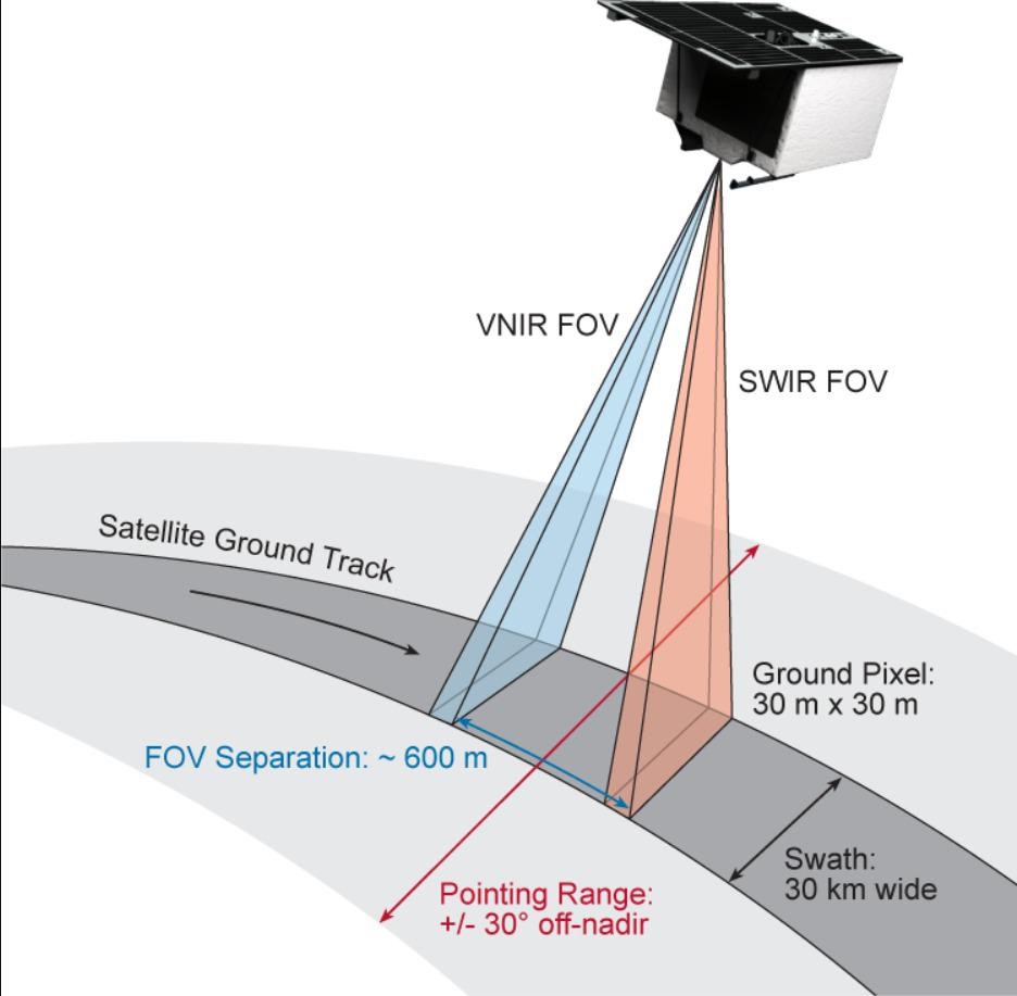
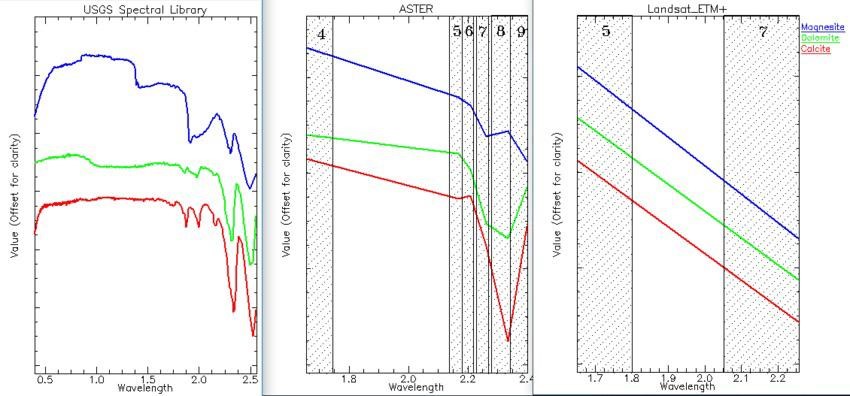
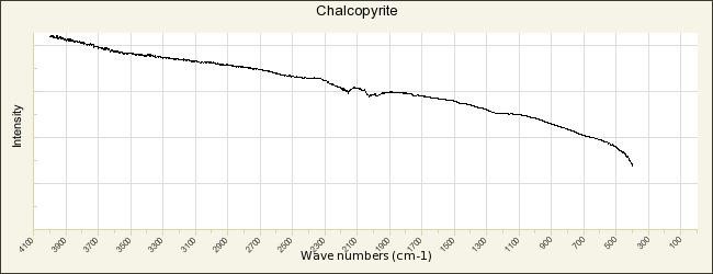
The project will study spectral lines as a result of multispectral remote sensing, managment of big Geodata in raster and vector formats, satellite image processing tools, morphological features of gold-bearing minerals and other important methods specified in the national projects of Kazakhstan: "Technological breakthrough through digitalization, science and innovation", "Sustainable economic growth aimed at improving the well-being of Kazakhstanis".
The goal of the project is to develop a combined method for predicting gold ore deposits based on satellite technologies, GIS, spectral geology, machine/deep learning AI. This approach aims to reduce the cost of satellite-based geological surveys and enhance it with AI-based predictive models.
Expected and achieved results of the project:
| Year |
The results obtained from the research. |
|---|---|
|
2025 |
|
| 2026 |
|
| 2027 |
|
Infographics
13.01.2026